
Botaya topographic map
Interactive map
Click on the map to display elevation.
About this map
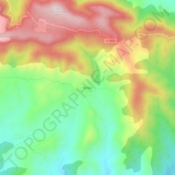
Name: Botaya topographic map, elevation, terrain.
Location: Botaya, La Jacetania, Huesca, Aragón, 22792, España (42.47326 -0.67229 42.51326 -0.63229)
Average elevation: 1,018 m
Minimum elevation: 806 m
Maximum elevation: 1,282 m