
Camden County topographic map
Interactive map
Click on the map to display elevation.
About this map
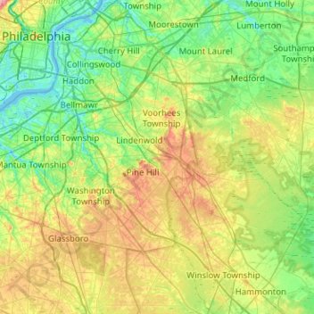
Name: Camden County topographic map, elevation, terrain.
Location: Camden County, New Jersey, Vereinigte Staaten von Amerika (39.60829 -75.13983 39.99608 -74.73631)
Average elevation: 26 m
Minimum elevation: -3 m
Maximum elevation: 79 m
Other topographic maps
Click on a map to view its topography, its elevation and its terrain.
Camden
Vereinigte Staaten von Amerika > New Jersey > Camden County > Camden
Camden, Camden County, New Jersey, 08102, Vereinigte Staaten von Amerika
Average elevation: 31 m