
Kuravilangad topographic map
Interactive map
Click on the map to display elevation.
About this map
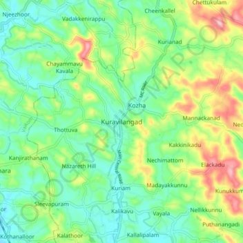
Name: Kuravilangad topographic map, elevation, terrain.
Location: Kuravilangad, Meenachil, Kottayam, Kerala, 686633, India (9.71731 76.52159 9.79731 76.60159)
Average elevation: 52 m
Minimum elevation: 4 m
Maximum elevation: 148 m
Other topographic maps
Click on a map to view its topography, its elevation and its terrain.
Erattupetta
Erattupetta, Meenachil, Kottayam, Kerala, 686122, India
Average elevation: 78 m
Pala Municipality Boarder with Mutholi Pachyath
Pala Municipality Boarder with Mutholi Pachyath, Meenachil, Kottayam, Kerala, 686574, India
Average elevation: 24 m
Pravithanam
Pravithanam, Meenachil, Kottayam District, Kerala, 686575, India
Average elevation: 58 m