
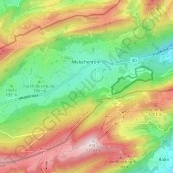
Welschenrohr-Gänsbrunnen topographic map
Interactive map
Click on the map to display elevation.
About this map
Name: Welschenrohr-Gänsbrunnen topographic map, elevation, terrain.
Average elevation: 823 m
Minimum elevation: 422 m
Maximum elevation: 1,392 m
Other topographic maps
Click on a map to view its topography, its elevation and its terrain.
Egerkingen
Schweiz > Solothurn > Amtei Thal-Gäu
Egerkingen, Bezirk Gäu, Amtei Thal-Gäu, Solothurn, 4622, Schweiz
Average elevation: 595 m