
Aux Houx topographic map
Interactive map
Click on the map to display elevation.
About this map
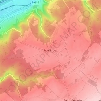
Name: Aux Houx topographic map, elevation, terrain.
Location: Aux Houx, Luik, Wallonië, 4480, België (50.52872 5.37932 50.56872 5.41932)
Average elevation: 205 m
Minimum elevation: 62 m
Maximum elevation: 264 m