
Tinta topographic map
Interactive map
Click on the map to display elevation.
About this map
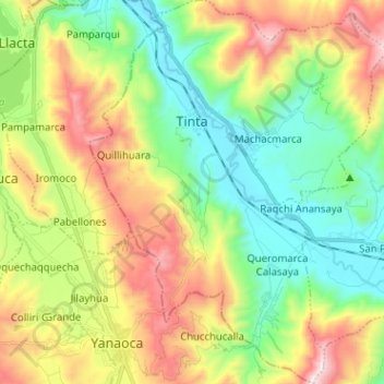
Name: Tinta topographic map, elevation, terrain.
Location: Tinta, Provincia de Canchis, Cuzco, Perú (-14.22990 -71.44111 -14.10662 -71.34227)
Average elevation: 3,836 m
Minimum elevation: 3,456 m
Maximum elevation: 4,470 m