
Malda topographic map
Click on the map to display elevation.
Malda
Malda is located at 25°00′43″N 88°08′36″E / 25.0119°N 88.1433°E / 25.0119; 88.1433. It has an average elevation of 17 metres (56 feet). It is situated on both the western and eastern banks of the river Mahananda.
About this map
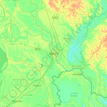
Name: Malda topographic map, elevation, terrain.
Location: Malda, English Bazar, Maldah, West Bengal, 732101, India (24.84574 87.97985 25.16574 88.29985)
Average elevation: 26 m
Minimum elevation: 13 m
Maximum elevation: 51 m