
Thank you for supporting this site ❤️
Make a donation
Make a donation
Jawai Dam topographic map
Click on the map to display elevation.
Thank you for supporting this site ❤️
Make a donation
Make a donation
About this map
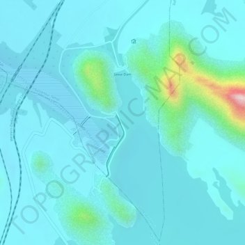
Name: Jawai Dam topographic map, elevation, terrain.
Location: Jawai Dam, Sumerpur Tehsil, Pali, Rajasthan, India (25.08680 73.14789 25.09909 73.15053)
Average elevation: 320 m
Minimum elevation: 274 m
Maximum elevation: 618 m
Thank you for supporting this site ❤️
Make a donation
Make a donation
Other topographic maps
Click on a map to view its topography, its elevation and its terrain.