
Thotagamuwa topographic map
Interactive map
Click on the map to display elevation.
About this map
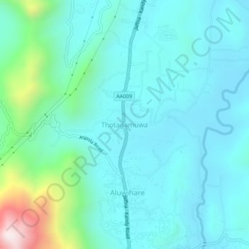
Name: Thotagamuwa topographic map, elevation, terrain.
Location: Thotagamuwa, Matale District, Central Province, 21070, Sri Lanka (7.48888 80.60294 7.52888 80.64294)
Average elevation: 464 m
Minimum elevation: 315 m
Maximum elevation: 1,186 m
Other topographic maps
Click on a map to view its topography, its elevation and its terrain.
upper division, north meddecombra
Sri Lanka > Central Province > upper division, north meddecombra
Average elevation: 1,268 m