
El Gamonal topographic map
Interactive map
Click on the map to display elevation.
About this map
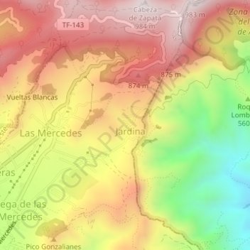
Name: El Gamonal topographic map, elevation, terrain.
Average elevation: 659 m
Minimum elevation: 266 m
Maximum elevation: 962 m
Other topographic maps
Click on a map to view its topography, its elevation and its terrain.
Punta del Hidalgo
Spanien > Kanarische Inseln > San Cristóbal de La Laguna
Punta del Hidalgo, San Cristóbal de La Laguna, Santa Cruz de Tenerife, Kanarische Inseln, 38240, Spanien
Average elevation: 17 m