
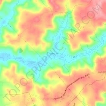
Paravoor topographic map
Interactive map
Click on the map to display elevation.
About this map
Name: Paravoor topographic map, elevation, terrain.
Average elevation: 73 m
Minimum elevation: 10 m
Maximum elevation: 128 m
Other topographic maps
Click on a map to view its topography, its elevation and its terrain.
Rajagiri
India > Kerala > Payyannur Taluk
Rajagiri, Payyannur Taluk, Kannur District, Kerala, 670354, India
Average elevation: 259 m
Pazhayangadi
India > Kerala > Payyannur Taluk
Pazhayangadi, Kalliasseri Block, Payyannur Taluk, Kannur District, Kerala, 670358, India
Average elevation: 9 m
Vellur
India > Kerala > Payyannur Taluk
Vellur, Payyannur Taluk, Kannur District, Kerala, 670307, India
Average elevation: 11 m
Payyanur
India > Kerala > Payyannur Taluk > Payyanur
Payyanur, Payyannur Taluk, Kannur district, Kerala, 671350, India
Average elevation: 8 m
Cherupuzha
India > Kerala > Payyannur Taluk
Cherupuzha, Payyannur Taluk, Kannur District, Kerala, 670511, India
Average elevation: 124 m
Ezhome
India > Kerala > Payyannur Taluk > Ezhom
Ezhome, Ezhom, Kalliasseri Block, Payyannur Taluk, Kannur district, Kerala, India
Average elevation: 14 m
Panappuzha
India > Kerala > Payyannur Taluk > Panappuzha
Panappuzha, Payyannur Taluk, Kannur district, Kerala, 670306, India
Average elevation: 48 m
Madayi
India > Kerala > Payyannur Taluk > Vengara
Madayi, Vengara, Kalliasseri Block, Payyannur Taluk, Kannur district, Kerala, India
Average elevation: 10 m
Payyannur
India > Kerala > Payyannur Taluk > Kavvayi
Payyannur, Kavvayi, Payyannur Taluk, Kannur district, Kerala, 670307, India
Average elevation: 19 m
Josegiri
India > Kerala > Payyannur Taluk > Josegiri
Josegiri, Payyannur Taluk, Kannur district, Kerala, India
Average elevation: 415 m