
Payyanur topographic map
Interactive map
Click on the map to display elevation.
About this map
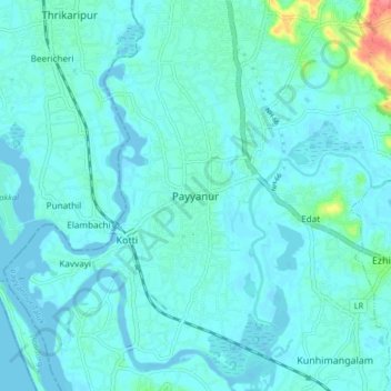
Name: Payyanur topographic map, elevation, terrain.
Average elevation: 8 m
Minimum elevation: -2 m
Maximum elevation: 66 m
Payyannur is located at coordinates 12°06′N 75°12′E / 12.1°N 75.2°E / 12.1; 75.2. It has an average elevation of 16 metres (51 feet).