
Maru topographic map
Interactive map
Click on the map to display elevation.
About this map
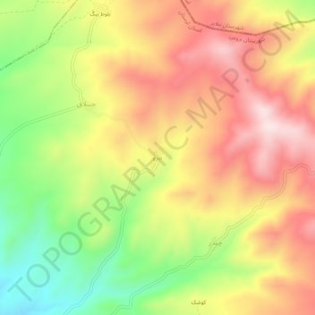
Name: Maru topographic map, elevation, terrain.
Average elevation: 2,243 m
Minimum elevation: 1,995 m
Maximum elevation: 2,459 m
Other topographic maps
Click on a map to view its topography, its elevation and its terrain.
Borujerd City
Iran > Lorestan Province > Borujerd County
Borujerd City, Central District, Borujerd County, Lorestan Province, Iran
Average elevation: 1,621 m