
Thank you for supporting this site ❤️
Make a donation
Make a donation
Twyford topographic map
Click on the map to display elevation.
Thank you for supporting this site ❤️
Make a donation
Make a donation
About this map
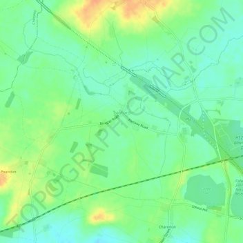
Name: Twyford topographic map, elevation, terrain.
Location: Twyford, Buckinghamshire, England, United Kingdom (51.91777 -1.06190 51.94259 -1.00414)
Average elevation: 89 m
Minimum elevation: 75 m
Maximum elevation: 111 m
Thank you for supporting this site ❤️
Make a donation
Make a donation