
Hidalgo County topographic map
Interactive map
Click on the map to display elevation.
About this map
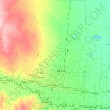
Name: Hidalgo County topographic map, elevation, terrain.
Location: Hidalgo County, Texas, Vereinigte Staaten von Amerika (26.03634 -98.58646 26.78303 -97.86161)
Average elevation: 47 m
Minimum elevation: 2 m
Maximum elevation: 155 m
Other topographic maps
Click on a map to view its topography, its elevation and its terrain.
McAllen
Vereinigte Staaten von Amerika > Texas > Hidalgo County > McAllen
McAllen, Hidalgo County, Texas, 78501, Vereinigte Staaten von Amerika
Average elevation: 37 m