
Thank you for supporting this site ❤️
Make a donation
Make a donation
Seeb topographic map
Click on the map to display elevation.
Thank you for supporting this site ❤️
Make a donation
Make a donation
About this map
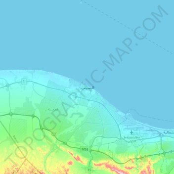
Name: Seeb topographic map, elevation, terrain.
Location: Seeb, Muscat, 121, Oman (23.52220 58.02438 23.84220 58.34438)
Average elevation: 30 m
Minimum elevation: -2 m
Maximum elevation: 371 m
Thank you for supporting this site ❤️
Make a donation
Make a donation