
Tortisambert topographic map
Interactive map
Click on the map to display elevation.
About this map
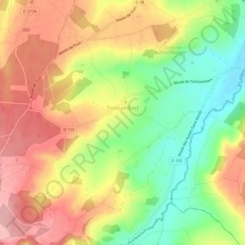
Name: Tortisambert topographic map, elevation, terrain.
Average elevation: 152 m
Minimum elevation: 76 m
Maximum elevation: 220 m
Other topographic maps
Click on a map to view its topography, its elevation and its terrain.
Livarot
France > Normandie > Calvados > Livarot-Pays-d'Auge
Livarot, Livarot-Pays-d'Auge, Lisieux, Calvados, Normandie, France métropolitaine, 14140, France
Average elevation: 128 m