
Mount Stanely topographic map
Interactive map
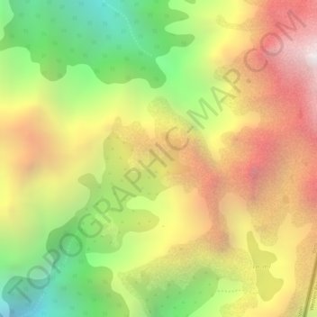
Click on the map to display elevation.
About this map
Name: Mount Stanely topographic map, elevation, terrain.
Average elevation: 4,141 m
Minimum elevation: 3,344 m
Maximum elevation: 4,839 m
Mount Stanley or Mount Ngaliema (/əŋɡɑːˈljeɪmə/, also US: /-mɑː/, UK: /əŋˌɡɑːliˈeɪmə/) is a mountain located in the Rwenzori Mountains. With an elevation of 5,109 m (16,763 ft), it is the highest mountain of both the Democratic Republic of the Congo and Uganda, and the third highest in Africa, after Kilimanjaro (5,895 m) and Mount Kenya (5,199 m). The peak and several other surrounding peaks are high enough to support glaciers. Mount Stanley is named for the journalist and explorer, Sir Henry Morton Stanley. It is part of the Rwenzori Mountains National Park, a UNESCO world Heritage Site.
Other topographic maps
Click on a map to view its topography, its elevation and its terrain.
Baruta
Democratic Republic of the Congo > North Kivu > Nyiragongo
Baruta, Bukumu, Nyiragongo, North Kivu, Democratic Republic of the Congo
Average elevation: 2,750 m
Kirumbu
Democratic Republic of the Congo > North Kivu > Kirumbu
Kirumbu, North Kivu, Democratic Republic of the Congo
Average elevation: 1,937 m
Terrain
Democratic Republic of the Congo > North Kivu > Beni
Terrain, Beni, North Kivu, Democratic Republic of the Congo
Average elevation: 1,084 m
Butembo
Democratic Republic of the Congo > North Kivu > Butembo
Butembo, North Kivu, 000, Democratic Republic of the Congo
Average elevation: 1,787 m