
Cascade Noire topographic map
Interactive map
Click on the map to display elevation.
About this map
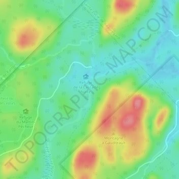
Name: Cascade Noire topographic map, elevation, terrain.
Average elevation: 409 m
Minimum elevation: 377 m
Maximum elevation: 463 m
Other topographic maps
Click on a map to view its topography, its elevation and its terrain.
Bonnet à Amédée
Canada > Québec > Saint-Fabien-de-Panet
Bonnet à Amédée, Saint-Fabien-de-Panet, Montmagny (MRC), Chaudière-Appalaches, Québec, Canada
Average elevation: 509 m