
Thank you for supporting this site ❤️
Make a donation
Make a donation
Teluk Kenali topographic map
Click on the map to display elevation.
Thank you for supporting this site ❤️
Make a donation
Make a donation
About this map
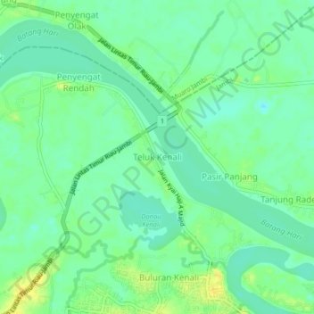
Name: Teluk Kenali topographic map, elevation, terrain.
Average elevation: 9 m
Minimum elevation: -1 m
Maximum elevation: 22 m
Thank you for supporting this site ❤️
Make a donation
Make a donation
Other topographic maps
Click on a map to view its topography, its elevation and its terrain.
Taman Anggrek Sri Sudewi
Indonesia > Jambi > Danau Sipin > Jambi > Telanaipura
Average elevation: 21 m
Thank you for supporting this site ❤️
Make a donation
Make a donation