
Thank you for supporting this site ❤️
Make a donation
Make a donation
Cella topographic map
Click on the map to display elevation.
Thank you for supporting this site ❤️
Make a donation
Make a donation
About this map
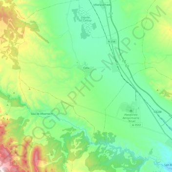
Name: Cella topographic map, elevation, terrain.
Location: Cella, Comunidad de Teruel, Teruel, Aragão, 44370, Espanha (40.35090 -1.37613 40.52145 -1.20666)
Average elevation: 1,098 m
Minimum elevation: 905 m
Maximum elevation: 1,599 m
Thank you for supporting this site ❤️
Make a donation
Make a donation