Tiwasa Bk topographic map
Interactive map
Click on the map to display elevation.
About this map
![Tiwasa Bk topographic map, elevation, terrain](/pub/maps/relation/pq51/2fgms8/thumbnail.jpg)
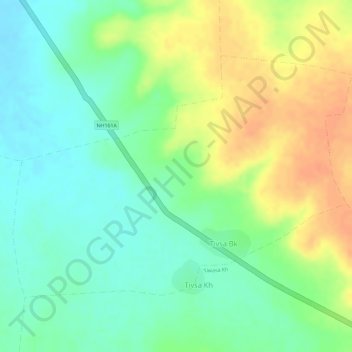
Name: Tiwasa Bk topographic map, elevation, terrain.
Location: Tiwasa Bk, Barshitakli, Akola, Maharashtra, 444401, India (20.51430 77.10136 20.53285 77.12913)
Average elevation: 339 m
Minimum elevation: 319 m
Maximum elevation: 363 m
Other topographic maps
Click on a map to view its topography, its elevation and its terrain.
![Dhanore topographic map, elevation, terrain](/pub/maps/relation/d8b3/2fbs18/icon.jpg)
Dhanore
India > Maharashtra > Barshitakli
Dhanore, Barshitakli, Akola, Maharashtra, India
Average elevation: 388 m