
Thank you for supporting this site ❤️
Make a donation
Make a donation
Miranda State topographic map
Click on the map to display elevation.
Thank you for supporting this site ❤️
Make a donation
Make a donation
About this map
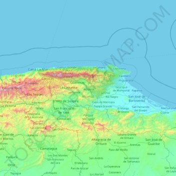
Name: Miranda State topographic map, elevation, terrain.
Location: Miranda State, Venezuela (9.93459 -67.22042 10.87641 -65.42090)
Average elevation: 244 m
Minimum elevation: 0 m
Maximum elevation: 2,639 m
Thank you for supporting this site ❤️
Make a donation
Make a donation