
Laakirchen topographic map
Interactive map
Click on the map to display elevation.
Laakirchen
Laakirchen liegt auf 441 m Höhe im Traunviertel. Die Ausdehnung beträgt von Nord nach Süd 7 km, von West nach Ost 7,7 km. Die Gesamtfläche beträgt 32,4 km². 11,1 % der Fläche sind bewaldet, 77,2 % der Fläche sind landwirtschaftlich genutzt.
About this map
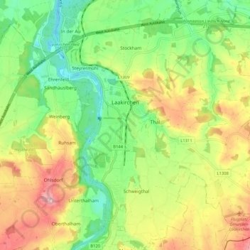
Name: Laakirchen topographic map, elevation, terrain.
Location: Laakirchen, Bezirk Gmunden, Oberösterreich, 4663, Österreich (47.94176 13.79377 48.01079 13.88664)
Average elevation: 464 m
Minimum elevation: 394 m
Maximum elevation: 556 m