
Thank you for supporting this site ❤️
Make a donation
Make a donation
Liège topographic map
Click on the map to display elevation.
Thank you for supporting this site ❤️
Make a donation
Make a donation
About this map
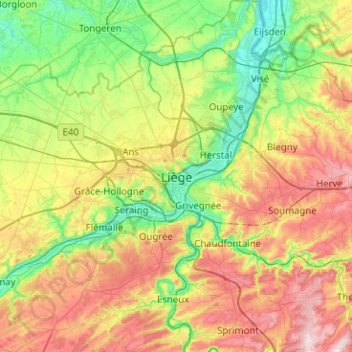
Name: Liège topographic map, elevation, terrain.
Location: Liège, Wallonia, 4000, Belgium (50.48514 5.41342 50.80514 5.73342)
Average elevation: 167 m
Minimum elevation: 46 m
Maximum elevation: 372 m
Thank you for supporting this site ❤️
Make a donation
Make a donation