
Thank you for supporting this site ❤️
Make a donation
Make a donation
McAllen topographic map
Click on the map to display elevation.
Thank you for supporting this site ❤️
Make a donation
Make a donation
About this map
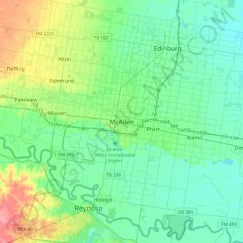
Name: McAllen topographic map, elevation, terrain.
Location: McAllen, Hidalgo County, Texas, 78501, United States (26.04411 -98.39006 26.36411 -98.07006)
Average elevation: 37 m
Minimum elevation: 21 m
Maximum elevation: 89 m
Thank you for supporting this site ❤️
Make a donation
Make a donation