
Rothrist topographic map
Interactive map
Click on the map to display elevation.
About this map
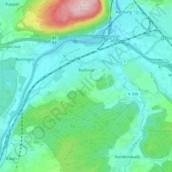
Name: Rothrist topographic map, elevation, terrain.
Location: Rothrist, Bezirk Zofingen, Aargau, 4852, Schweiz (47.28029 7.85161 47.31574 7.92843)
Average elevation: 456 m
Minimum elevation: 388 m
Maximum elevation: 720 m