
Monteggio topographic map
Interactive map
Click on the map to display elevation.
About this map
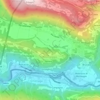
Name: Monteggio topographic map, elevation, terrain.
Average elevation: 408 m
Minimum elevation: 243 m
Maximum elevation: 704 m
Die Ortschaft liegt mitten in Weinbergen auf 420–433 m ü. M. auf einer das ganze obere Val Tresa beherrschenden Anhöhe, 1,5 km nördlich des Cremenaga. Die Gemeinde besteht aus 26 Fraktionen: Bosco, Bruciata, Busino, Calangeli, Cassinone, Castello, Crocivaglio, Fonderia, Fornasette, Genestraio, Isole, Lisora, Molinazzo, Persico, Pirla, Ponte Cremenaga, Ramello, Rancina, Ressiga, Roncaccio, Ronchetto, Rovedera, Selvacce, Suino, Termine und Tiradelza.