
Thank you for supporting this site ❤️
Make a donation
Make a donation
Kiriella topographic map
Click on the map to display elevation.
Thank you for supporting this site ❤️
Make a donation
Make a donation
About this map
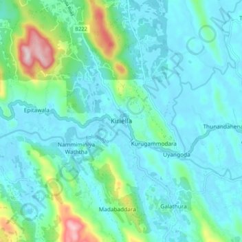
Name: Kiriella topographic map, elevation, terrain.
Location: Kiriella, Ratnapura District, Sabaragamuwa Province, Sri Lanka (6.69796 80.23308 6.77796 80.31308)
Average elevation: 86 m
Minimum elevation: 7 m
Maximum elevation: 466 m
Thank you for supporting this site ❤️
Make a donation
Make a donation
Other topographic maps
Click on a map to view its topography, its elevation and its terrain.