
Munte topographic map
Interactive map
Click on the map to display elevation.
About this map
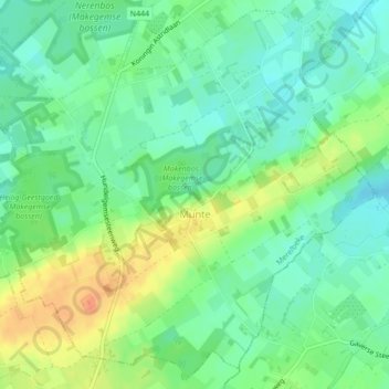
Name: Munte topographic map, elevation, terrain.
Location: Munte, Merelbeke, Gent, East Flanders, Flanders, Belgium (50.93375 3.72311 50.95940 3.76450)
Average elevation: 33 m
Minimum elevation: 16 m
Maximum elevation: 59 m
Other topographic maps
Click on a map to view its topography, its elevation and its terrain.
Merelbeke
Belgium > East Flanders > Gent > Merelbeke
Merelbeke, Gent, East Flanders, Flanders, 9820, Belgium
Average elevation: 13 m