
La Grolle topographic map
Interactive map
Click on the map to display elevation.
About this map
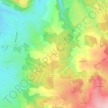
Name: La Grolle topographic map, elevation, terrain.
Average elevation: 786 m
Minimum elevation: 678 m
Maximum elevation: 927 m
Other topographic maps
Click on a map to view its topography, its elevation and its terrain.
Le Vedeux
France > Auvergne-Rhône-Alpes > Puy-de-Dôme > Prondines
Le Vedeux, Prondines, Riom, Puy-de-Dôme, Auvergne-Rhône-Alpes, France métropolitaine, 63470, France
Average elevation: 876 m
Arfeuilles
France > Auvergne-Rhône-Alpes > Puy-de-Dôme > Prondines
Arfeuilles, Prondines, Riom, Puy-de-Dôme, Auvergne-Rhône-Alpes, France métropolitaine, 63470, France
Average elevation: 875 m