
Roter Stein topographic map
Interactive map
Click on the map to display elevation.
About this map
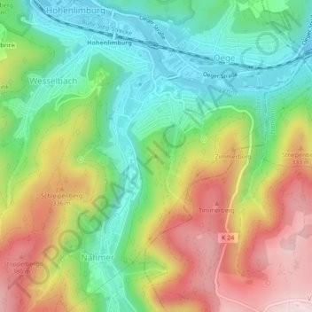
Name: Roter Stein topographic map, elevation, terrain.
Location: Roter Stein, Hagen, Nordrhein-Westfalen, 58119, Deutschland (51.33829 7.57819 51.33839 7.57829)
Average elevation: 243 m
Minimum elevation: 116 m
Maximum elevation: 420 m