
Thank you for supporting this site ❤️
Make a donation
Make a donation
Bakar Kapor topographic map
Click on the map to display elevation.
Thank you for supporting this site ❤️
Make a donation
Make a donation
About this map
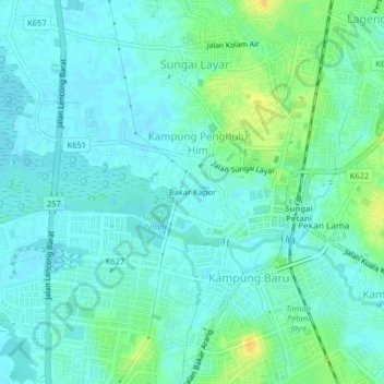
Name: Bakar Kapor topographic map, elevation, terrain.
Location: Bakar Kapor, Sungai Petani, Kuala Muda, Kedah, 08000, Malaysia (5.62380 100.45898 5.66380 100.49898)
Average elevation: 8 m
Minimum elevation: 1 m
Maximum elevation: 26 m
Thank you for supporting this site ❤️
Make a donation
Make a donation
Other topographic maps
Click on a map to view its topography, its elevation and its terrain.