
Thank you for supporting this site ❤️
Make a donation
Make a donation
Scotsdale topographic map
Click on the map to display elevation.
Thank you for supporting this site ❤️
Make a donation
Make a donation
About this map
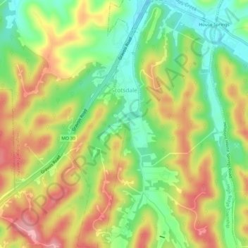
Name: Scotsdale topographic map, elevation, terrain.
Location: Scotsdale, Jefferson County, Missouri, United States (38.37547 -90.59817 38.41256 -90.58180)
Average elevation: 196 m
Minimum elevation: 134 m
Maximum elevation: 264 m
Thank you for supporting this site ❤️
Make a donation
Make a donation