
The Municipal District of Newcastle West topographic map
Interactive map
Click on the map to display elevation.
About this map
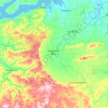
Name: The Municipal District of Newcastle West topographic map, elevation, terrain.
Average elevation: 117 m
Minimum elevation: -2 m
Maximum elevation: 407 m
Other topographic maps
Click on a map to view its topography, its elevation and its terrain.
Galway
Irlande > Comté de Limerick > The Municipal District of Adare — Rathkeale
Galway, Iveruss, The Municipal District of Adare — Rathkeale, Comté de Limerick, Munster, Irlande
Average elevation: 17 m
Limerick
Limerick, Comté de Limerick, Munster, Irlande
Average elevation: 45 m