
As Sarj topographic map
Interactive map
Click on the map to display elevation.
About this map
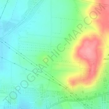
Name: As Sarj topographic map, elevation, terrain.
Location: As Sarj, Alep, منطقة جبل سمعان, Gouvernorat d'Alep, Syrie (36.23328 37.24995 36.23338 37.25005)
Average elevation: 463 m
Minimum elevation: 428 m
Maximum elevation: 531 m