
Duppituru topographic map
Interactive map
Click on the map to display elevation.
About this map
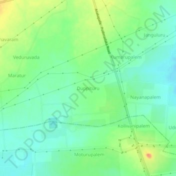
Name: Duppituru topographic map, elevation, terrain.
Average elevation: 22 m
Minimum elevation: 6 m
Maximum elevation: 49 m
Other topographic maps
Click on a map to view its topography, its elevation and its terrain.
Dosuru
India > Andhra Pradesh > Atchutapuram
Dosuru, Atchutapuram, Anakapalli, Andhra Pradesh, India
Average elevation: 26 m