
Ljungby topographic map
Interactive map
Click on the map to display elevation.
About this map
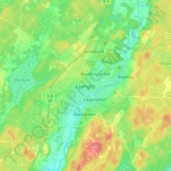
Name: Ljungby topographic map, elevation, terrain.
Location: Ljungby, Kronobergs län, Götaland, 341 21, Zweden (56.79259 13.89599 56.87259 13.97599)
Average elevation: 153 m
Minimum elevation: 126 m
Maximum elevation: 197 m