
Thank you for supporting this site ❤️
Make a donation
Make a donation
Doubtful Sound topographic map
Click on the map to display elevation.
Thank you for supporting this site ❤️
Make a donation
Make a donation
About this map
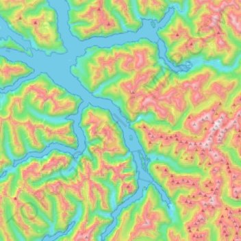
Name: Doubtful Sound topographic map, elevation, terrain.
Average elevation: 560 m
Minimum elevation: -1 m
Maximum elevation: 1,636 m
Thank you for supporting this site ❤️
Make a donation
Make a donation
Other topographic maps
Click on a map to view its topography, its elevation and its terrain.
Te Anau
New Zealand > Southland > Southland District > Fiordland Community > Te Anau
Average elevation: 249 m