
Cassongue topographic map
Interactive map
Click on the map to display elevation.
About this map
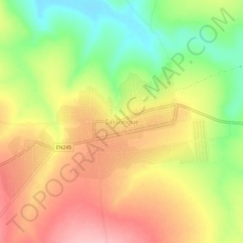
Name: Cassongue topographic map, elevation, terrain.
Location: Cassongue, Cuanza Sul Province, Angola (-11.87329 15.02756 -11.83329 15.06756)
Average elevation: 1,552 m
Minimum elevation: 1,473 m
Maximum elevation: 1,621 m