
Thank you for supporting this site ❤️
Make a donation
Make a donation
Ashland topographic map
Click on the map to display elevation.
Thank you for supporting this site ❤️
Make a donation
Make a donation
About this map
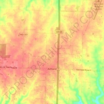
Name: Ashland topographic map, elevation, terrain.
Location: Ashland, Boone County, Missouri, 65010, United States (38.75267 -92.27630 38.81735 -92.22440)
Average elevation: 262 m
Minimum elevation: 213 m
Maximum elevation: 286 m
Thank you for supporting this site ❤️
Make a donation
Make a donation