
Thank you for supporting this site ❤️
Make a donation
Make a donation
Acton topographic map
Click on the map to display elevation.
Thank you for supporting this site ❤️
Make a donation
Make a donation
About this map
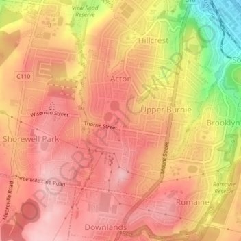
Name: Acton topographic map, elevation, terrain.
Location: Acton, Burnie, City of Burnie, Tasmania, 7320, Australia (-41.08027 145.88699 -41.06436 145.89910)
Average elevation: 128 m
Minimum elevation: 7 m
Maximum elevation: 183 m
Thank you for supporting this site ❤️
Make a donation
Make a donation