
Thank you for supporting this site ❤️
Make a donation
Make a donation
Waterford topographic map
Click on the map to display elevation.
Thank you for supporting this site ❤️
Make a donation
Make a donation
About this map
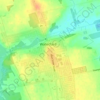
Name: Waterford topographic map, elevation, terrain.
Location: Waterford, Norfolk County, Ontario, N0E 1Y0, Canada (42.92291 -80.30002 42.94291 -80.28002)
Average elevation: 241 m
Minimum elevation: 221 m
Maximum elevation: 259 m
Thank you for supporting this site ❤️
Make a donation
Make a donation