
Flat topographic map
Interactive map
Click on the map to display elevation.
About this map
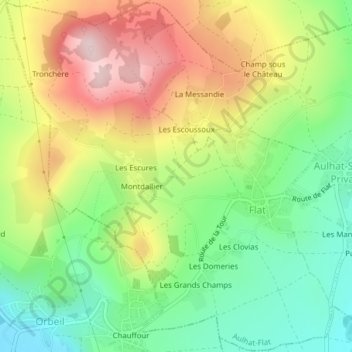
Name: Flat topographic map, elevation, terrain.
Average elevation: 498 m
Minimum elevation: 364 m
Maximum elevation: 671 m
Other topographic maps
Click on a map to view its topography, its elevation and its terrain.
Les Clovias
France > Auvergne-Rhône-Alpes > Puy-de-Dôme > Aulhat-Flat
Les Clovias, Flat, Aulhat-Flat, Issoire, Puy-de-Dôme, Auvergne-Rhône-Alpes, France métropolitaine, 63500, France
Average elevation: 456 m