
长春净月高新技术产业开发区 topographic map
Interactive map
Click on the map to display elevation.
About this map
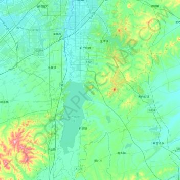
Name: 长春净月高新技术产业开发区 topographic map, elevation, terrain.
Location: 长春净月高新技术产业开发区, 南关区, 长春市, 吉林省, 130000, 中国 (43.51166 125.29981 43.85975 125.57165)
Average elevation: 244 m
Minimum elevation: 194 m
Maximum elevation: 493 m
Other topographic maps
Click on a map to view its topography, its elevation and its terrain.