
Strombach topographic map
Interactive map
Click on the map to display elevation.
About this map
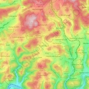
Name: Strombach topographic map, elevation, terrain.
Average elevation: 297 m
Minimum elevation: 149 m
Maximum elevation: 433 m
Other topographic maps
Click on a map to view its topography, its elevation and its terrain.
Mühlenseßmar
Deutschland > Nordrhein-Westfalen > Oberbergischer Kreis > Gummersbach
Mühlenseßmar, Gummersbach, Oberbergischer Kreis, Nordrhein-Westfalen, 51647, Deutschland
Average elevation: 281 m