
Geisenheim topographic map
Interactive map
Click on the map to display elevation.
About this map
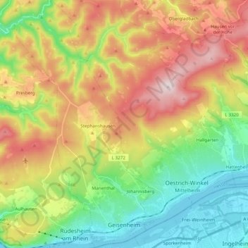
Name: Geisenheim topographic map, elevation, terrain.
Location: Geisenheim, Rheingau-Taunus-Kreis, Hessen, 65366, Alemanha (49.97501 7.88282 50.09745 7.99217)
Average elevation: 305 m
Minimum elevation: 78 m
Maximum elevation: 626 m