
Rutegama topographic map
Interactive map
Click on the map to display elevation.
About this map
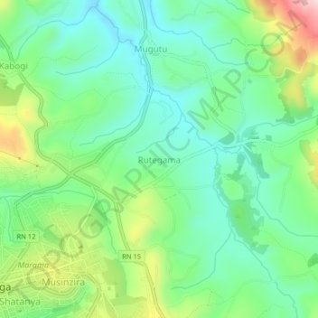
Name: Rutegama topographic map, elevation, terrain.
Location: Rutegama, Gitega, Burundi (-3.43253 29.92562 -3.39253 29.96562)
Average elevation: 1,646 m
Minimum elevation: 1,550 m
Maximum elevation: 1,856 m
Other topographic maps
Click on a map to view its topography, its elevation and its terrain.