
Navistal topographic map
Interactive map
Click on the map to display elevation.
About this map
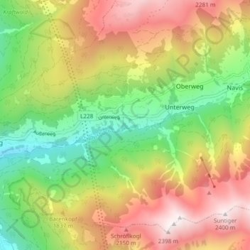
Name: Navistal topographic map, elevation, terrain.
Average elevation: 1,675 m
Minimum elevation: 1,049 m
Maximum elevation: 2,412 m
Other topographic maps
Click on a map to view its topography, its elevation and its terrain.
Koatzet
Österreich > Tirol > Bezirk Innsbruck-Land > Unterweg
Koatzet, Unterweg, Gemeinde Navis, Bezirk Innsbruck-Land, Tirol, 6145, Österreich
Average elevation: 1,621 m