419 topographic map
Interactive map
Click on the map to display elevation.
About this map
![419 topographic map, elevation, terrain](/pub/maps/way/wx5k/wjj85vnx/thumbnail.jpg)
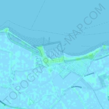
Name: 419 topographic map, elevation, terrain.
Location: 419, Noord-Beveland, Zeeland, Netherlands (51.59252 3.71749 51.59257 3.71763)
Average elevation: 0 m
Minimum elevation: -2 m
Maximum elevation: 5 m
Other topographic maps
Click on a map to view its topography, its elevation and its terrain.
![234 topographic map, elevation, terrain](/pub/maps/way/fsgt/s6d82hf3/icon.jpg)
234
Netherlands > Zeeland > Noord-Beveland
234, Noord-Beveland, Zeeland, Netherlands
Average elevation: 0 m
![357 topographic map, elevation, terrain](/pub/maps/way/knkl/8ffmx39m/icon.jpg)
357
Netherlands > Zeeland > Noord-Beveland
357, Noord-Beveland, Zeeland, Netherlands
Average elevation: 0 m